Log MiniCarta

MiniCarta is simple sync'ed mapping for groups.
Locate and tag points on a private map.
Share with anyone you like.

  • No hosting costs
  • Use your device's GPS or pick a point on the map to tag
  • Live syncing and connections to your whole team
  • Activity specific icon packs [PRO feature]
  • Attach photos and structured data to your tagged points
  • Download your data in GIS/Google Earth/Excel and more [PRO feature]

Features

The simplest mapping application ever

You don't need to be a GIS analyst or have specialized hardware to tag and annotate your map.

Activity specific icon packs

We have built specific icon packs into MiniCarta that match your field activitites exactly. There are icons for public safety, environmental field work, utilities survey, hunting, fishing, real estate and more. We are adding to the icon packs every day.

Start out for free

MiniCarta's free version has a variety of shapes and colors to choose from for your basic icons. You still get all of the sharing, syncing, and publishing as in the full verision. So you can try it out with your group and upgrade later when you want to use the Pro features.

Get all your points sent by email

Save your points in text format for download. MiniCarta PRO can convert your project tagged points into GIS, CAD, Google Earth, Excel, and CSV files. So you can share your data with the back office or archive it for posterity.

Share and collaborate on maps

You don't have to go it alone. Share your map and let your whole team work on the same map. You see what they tag, they see what you tag. All in real time.

Dozens of maps to reference

All versions of MiniCarta have over a dozen map types for you. City Maps, Aerial imagery, Nautical charts, Aeronautical charts, Topographic maps, Historical maps, Geologic maps, and more.

How it works

Using unique icons in the maps you share and collaborate on is important because it creates a common language for everyone you share your map with. Whether it's a small group of friends, a team of professionals, or 1000s of people at an amusement park or music festival - MiniCarta can keep you in sync and aware of your surroundings.

Scan the QR codes

Download for iOS

Download for Andriod

Questions you might be asking

What if I don't have internet service when I'm in the field?

MiniCarta downloads your available icon packs and can sync up with a map project, then if you move out of range of mobile data, you can still tag locations, and MiniCarta will sync with everyone when you regain data service.

How many maps can I create and share?

Even the free version of MiniCarta has unlimited maps and sharing between users.

How does map sharing work?

When you create a map, you can share it with as many people as you like. Any icons you place on the map will remain with that map, and you can share your unique map with your family, team, buddies, or the world. Whoever you want to share and collaborate with. Once they join your map, they are tagging alongside you. Any points you place, they see immediately, and you see the ones they add.

Can I get my data out of MiniCarta?

Of course! All users can get CSV files. Pro users have a feature to send the point data to an email address. We include GIS, CAD, Google Earth, Excel, and CSV file formats.

More questions?

Get in touch

Story behind the app

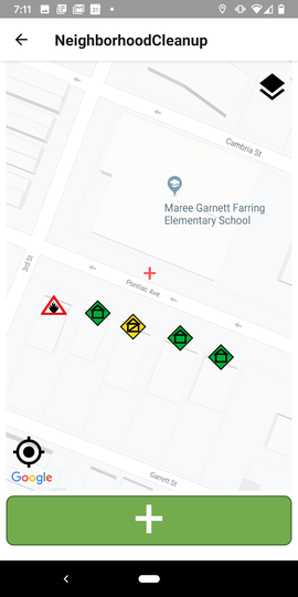
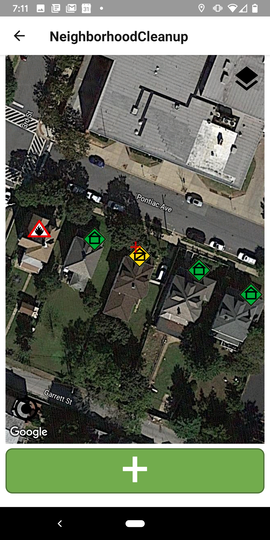
This all started at a training for a state disaster response team. The team needed a way to track, annotate, and clear hazards and damage from severe weather and other wide area disasters.

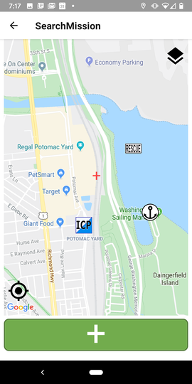
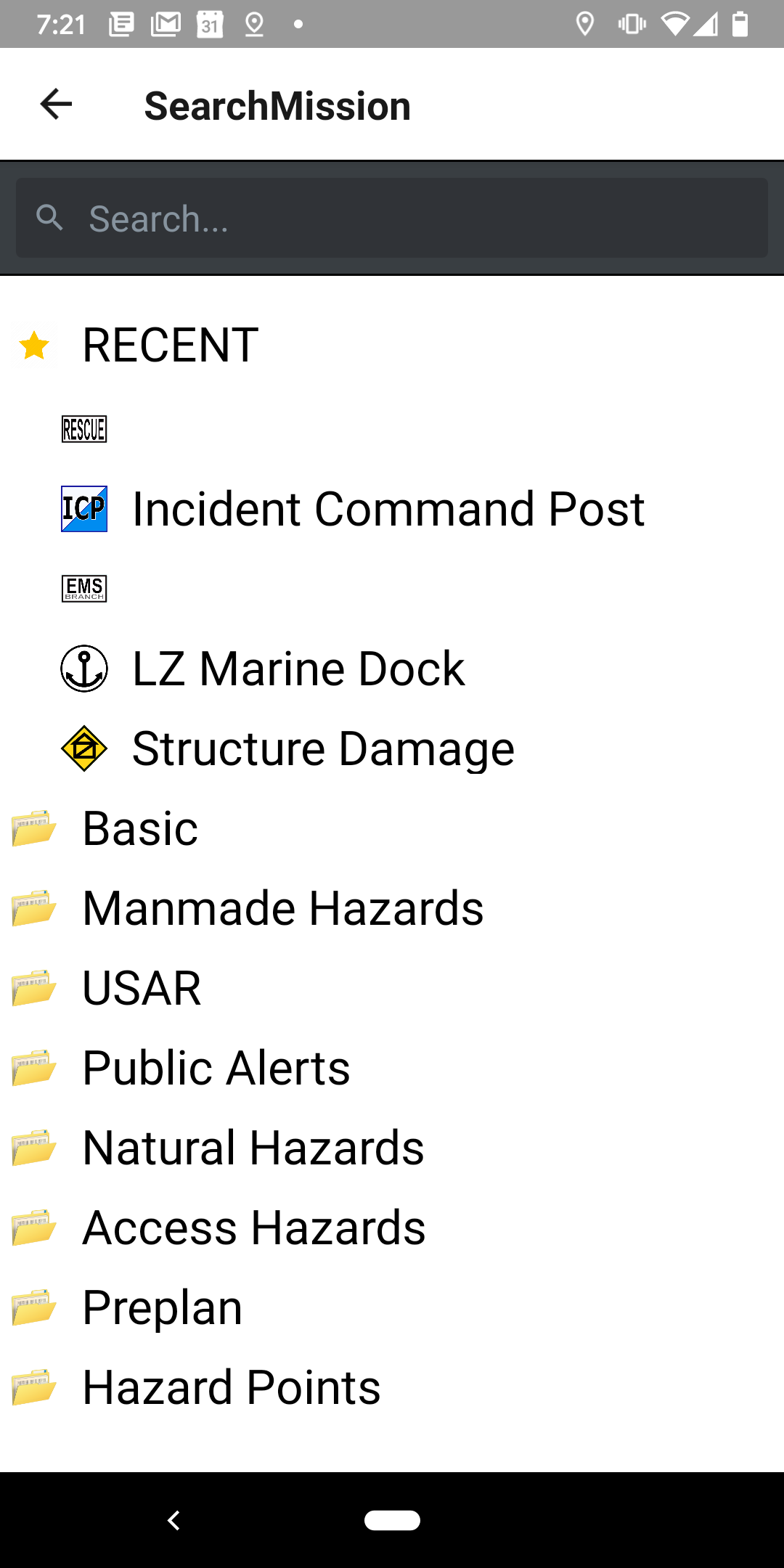
The solutions available were either based on dedicated handheld GPS units, which didn't have a good user interface or unique icons for the detailed maps the teams wanted to create. Another option used subscription GIS services and required a GIS analyst behind the scenes to set up and distribute web maps. After that weekend of training, the ideas for MiniCarta started to take shape. A simple app with a fast robust data backend that could distribute and display point annotations from a widespread team.

MiniCarta is a creation of Azimuth1, a tech development company based in Virginia. If you want to learn more about us, please visit Azimuth1.com We built MiniCarta for our friends in public safety, but found that lots of people like simple fast mapping across teams. Check out the PRO version for custom icon packs, and GIS integration.

Contact Us

We’d love to hear from you. If you find MiniCarta helpful, help spread the word on Facebook and Twitter with #MiniCarta.